El Paso to Tokyo is 6,076 miles (9,778 km), a flight of about 13 hours 30 minutes.
Left side wins both the departure and arrival phases. At takeoff you get the dramatic Franklin Mountains and the El Paso-Juárez border geography, and on arrival you get the Tokyo Bay and Kanto Plain panorama. The transpacific cruise itself offers little to differentiate sides, so the bookend views make left the clear overall choice.
Flight Path
The great circle route from El Paso to Tokyo tracks northwest over the American Southwest and California coast, then arcs across the North Pacific. Features include the Sierra Nevada and California Central Valley during initial climb, the California coastline near Los Angeles or Monterey, then open North Pacific Ocean for the bulk of the flight with the Aleutian Islands chain visible to the north in clear conditions, before descending toward the Kanto Plain and Tokyo Bay on the Japanese side.
Great circle distance and headings ›.jpg?width=600)


.jpeg?width=600)


Phase by phase
Takeoff from ELP
LEFTEl Paso International's primary departure runway 04 takes you northeast, putting the Franklin Mountains and downtown El Paso on your left (west) side. The Rio Grande and Ciudad Juárez spread out clearly below, with the Organ Mountains visible to the left in the distance.
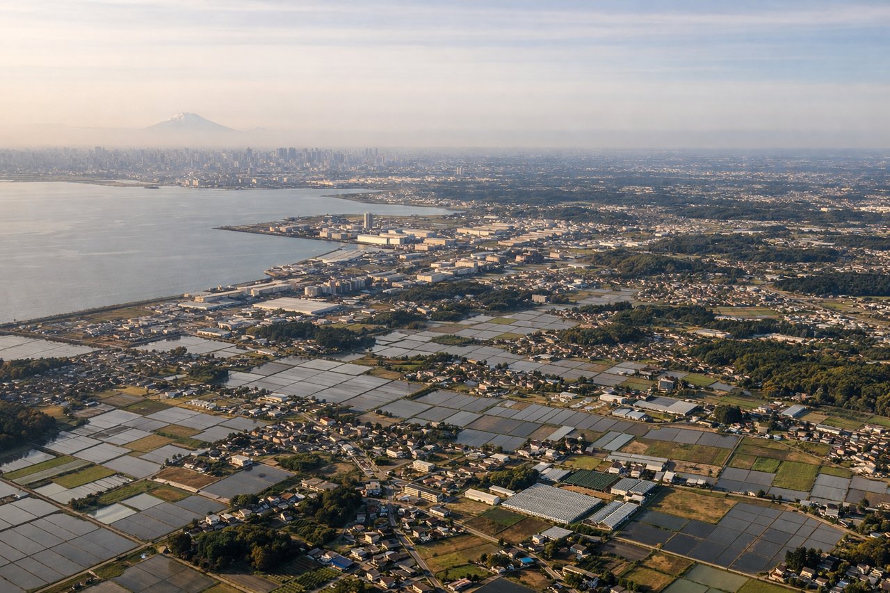
Landing at NRT
LEFTNRT's primary landing approach on runway 34L brings aircraft in from the south over Tokyo Bay, placing the bay and central Tokyo on the left (west) side. You get a clear view of the Tokyo waterfront, the bay, and the city skyline as you descend over Chiba Prefecture.
Landmarks on this routeAll landmarks →
Will your flight be in sunlight?
Pick a date and time in the Sun Map to watch the sun move across your whole flight.
About This Route
Which side of the plane should I sit on flying from El Paso International (ELP) to New Tokyo International (NRT)?
Sit on the Left side of the plane for the best views on flights from El Paso to Tokyo. Left side wins both the departure and arrival phases. At takeoff you get the dramatic Franklin Mountains and the El Paso-Juárez border geography, and on arrival you get the Tokyo Bay and Kanto Plain panorama. The transpacific cruise itself offers little to differentiate sides, so the bookend views make left the clear overall choice.
What can I see during takeoff from El Paso International in El Paso?
During takeoff from El Paso International (ELP), sit on the Left side for the best views. El Paso International's primary departure runway 04 takes you northeast, putting the Franklin Mountains and downtown El Paso on your left (west) side. The Rio Grande and Ciudad Juárez spread out clearly below, with the Organ Mountains visible to the left in the distance. Notable sights include: Franklin Mountains State Park, Rio Grande/Ciudad Juárez border, Organ Mountains (30 miles east-southeast), downtown El Paso urban grid.
What can I see when landing at New Tokyo International in Tokyo?
When landing at New Tokyo International (NRT), sit on the Left side for the best views. NRT's primary landing approach on runway 34L brings aircraft in from the south over Tokyo Bay, placing the bay and central Tokyo on the left (west) side. You get a clear view of the Tokyo waterfront, the bay, and the city skyline as you descend over Chiba Prefecture. Notable sights include: Tokyo Bay, Tokyo waterfront and urban core, Chiba city and suburbs, Narita city below final approach.
How long is the flight from El Paso to Tokyo?
The flight from El Paso International (ELP) to New Tokyo International (NRT) takes about 13 hours 30 minutes. The shortest flight path between them is 6,076 miles (9,778 km); winds and air traffic control usually add a few percent.
What does the El Paso to Tokyo flight path pass over?
The great circle route from El Paso to Tokyo tracks northwest over the American Southwest and California coast, then arcs across the North Pacific. Features include the Sierra Nevada and California Central Valley during initial climb, the California coastline near Los Angeles or Monterey, then open North Pacific Ocean for the bulk of the flight with the Aleutian Islands chain visible to the north in clear conditions, before descending toward the Kanto Plain and Tokyo Bay on the Japanese side.