The left side delivers the more dramatic Tokyo departure with the city skyline and potential Fuji views, and while the right side wins on landing for Diamond Head, the takeoff spectacle over one of the world's great cities edges out the approach view. On a 9-hour transoceanic flight over featureless ocean, the departure scenery matters most.
Flight Path
The route tracks northeast from Tokyo before curving southeast across the North Pacific on a great circle arc. The flight passes south of the Aleutian Island chain (occasionally visible as dark volcanic peaks through cloud gaps), crosses the International Date Line roughly 3-4 hours out of Tokyo, and traverses the largely featureless central North Pacific. The Hawaiian Islands appear as the only land for the final 2,400 miles of the route. No significant island chains or landmasses lie along the central portion of this track.
Great circle distance and headings ›


Phase by phase

Takeoff from HND
LEFTHND typically departs eastward over Tokyo Bay on runways 34L/34R or 05, then turns northeast. Left side gives you the Tokyo skyline, including the Tokyo Tower and Skytree visible across the bay, plus the dense urban grid of central Tokyo. Right side faces open water of Tokyo Bay with little of interest.
Landing at HNL
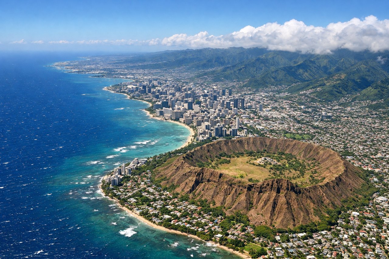
RIGHTHNL typically lands from the east on runway 08L/08R, approaching over the ocean from the southeast. The right side faces Diamond Head crater and the Waikiki beachfront as you descend over the coast, while the left side looks north toward Pearl Harbor and the Ewa Plain, which is also notable but less iconic.
Landmarks on this routeAll landmarks →
Will your flight be in sunlight?
See exactly which side of the plane gets sun and shade at your departure time.
About This Route
Which side of the plane should I sit on flying from Tokyo International (HND) to Honolulu International (HNL)?
Sit on the Left side of the plane for the best views on flights from Tokyo to Honolulu. The left side delivers the more dramatic Tokyo departure with the city skyline and potential Fuji views, and while the right side wins on landing for Diamond Head, the takeoff spectacle over one of the world's great cities edges out the approach view. On a 9-hour transoceanic flight over featureless ocean, the departure scenery matters most.
What can I see during takeoff from Tokyo International in Tokyo?
During takeoff from Tokyo International (HND), sit on the Left side for the best views. HND typically departs eastward over Tokyo Bay on runways 34L/34R or 05, then turns northeast. Left side gives you the Tokyo skyline, including the Tokyo Tower and Skytree visible across the bay, plus the dense urban grid of central Tokyo. Right side faces open water of Tokyo Bay with little of interest. Notable sights include: Tokyo Skytree, Tokyo Tower, Mount Fuji (visible to the southwest on clear days during the climbing turn), Yokohama port and waterfront.
What can I see when landing at Honolulu International in Honolulu?
When landing at Honolulu International (HNL), sit on the Right side for the best views. HNL typically lands from the east on runway 08L/08R, approaching over the ocean from the southeast. The right side faces Diamond Head crater and the Waikiki beachfront as you descend over the coast, while the left side looks north toward Pearl Harbor and the Ewa Plain, which is also notable but less iconic. Notable sights include: Diamond Head crater, Waikiki Beach and hotel strip, Pearl Harbor and Ford Island, Honolulu downtown skyline.
How long is the flight from Tokyo to Honolulu?
The flight from Tokyo International (HND) to Honolulu International (HNL) takes Approximately 8.5 to 9.5 hours.
What does the Tokyo to Honolulu flight path pass over?
The route tracks northeast from Tokyo before curving southeast across the North Pacific on a great circle arc. The flight passes south of the Aleutian Island chain (occasionally visible as dark volcanic peaks through cloud gaps), crosses the International Date Line roughly 3-4 hours out of Tokyo, and traverses the largely featureless central North Pacific. The Hawaiian Islands appear as the only land for the final 2,400 miles of the route. No significant island chains or landmasses lie along the central portion of this track.