While takeoff offers good coastal views on the right, the landing approach on the left provides more dramatic and sustained geography—the Aravalli Range, Yamuna River, and Delhi's sprawling urban landscape are far more visually distinctive than the relatively flat Yellow Sea departure.
Flown ICN to DEL? Did we get it right?
Flight Path
Seoul to Delhi is 2,892 miles (4,654 km), a flight of about 6 hours 5 minutes.
The flight path crosses the Gangetic Plain, one of the world's most densely populated regions. Over northern India, you'll pass above the flat alluvial plains of Uttar Pradesh and the Ganges River valley—largely obscured by haze and cloud at cruise altitude. The Himalayas lie well to the north of the direct routing and are not typically visible. The landscape transitions from the Korean peninsula's mountainous terrain through China's eastern plains, then across the vast Indo-Gangetic flatlands. Agricultural patchwork, river systems, and scattered cities dominate the midpoint, though visibility is often limited by atmospheric haze over the Indian subcontinent.
Great circle distance and headings ›

Phase by phase
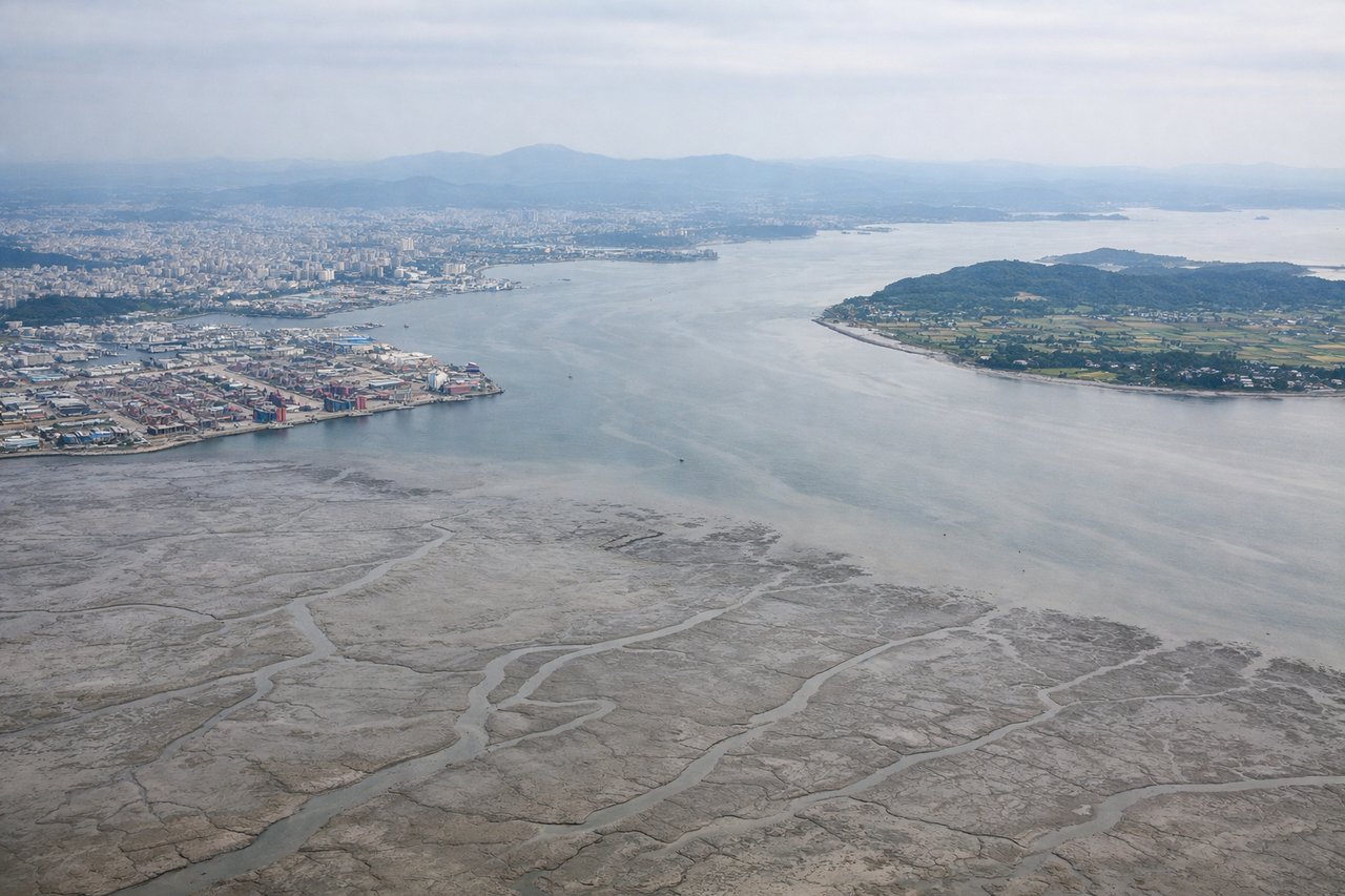
Takeoff from ICN
RIGHTRight-side seats capture the initial climb over the Yellow Sea and the Korean peninsula's western coastline. Incheon typically departs westbound (Runway 34L/34R), so right windows face toward the sea and the receding Korean coast.
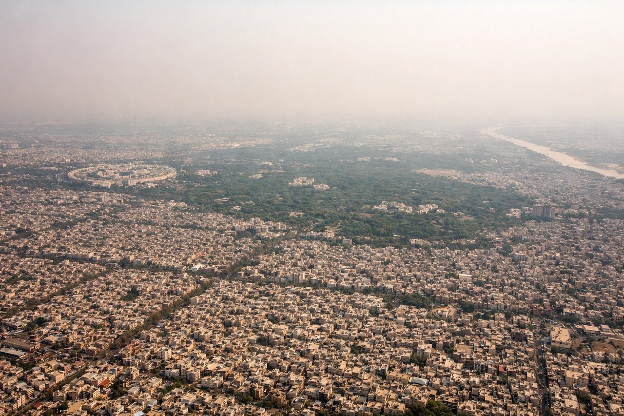
Landing at DEL
LEFTLeft-side seats offer the best views during descent into Delhi. The approach typically uses Runway 28L/28R, and left windows face south and southeast toward the Aravalli Range foothills and the Yamuna River valley—the defining geography of Delhi's approach corridor.
Will your flight be in sunlight?
Pick a date and time in the Sun Map to watch the sun move across your whole flight.
About This Route
Which side of the plane should I sit on flying from Incheon International (ICN) to Indira Gandhi International (DEL)?
Sit on the Left side of the plane for the best views on flights from Seoul to Delhi. While takeoff offers good coastal views on the right, the landing approach on the left provides more dramatic and sustained geography—the Aravalli Range, Yamuna River, and Delhi's sprawling urban landscape are far more visually distinctive than the relatively flat Yellow Sea departure.
What can I see during takeoff from Incheon International in Seoul?
During takeoff from Incheon International (ICN), sit on the Right side for the best views. Right-side seats capture the initial climb over the Yellow Sea and the Korean peninsula's western coastline. Incheon typically departs westbound (Runway 34L/34R), so right windows face toward the sea and the receding Korean coast. Notable sights include: Yellow Sea (immediate offshore), Incheon's industrial port facilities, Korean peninsula's western coastal plains, Han River estuary.
What can I see when landing at Indira Gandhi International in Delhi?
When landing at Indira Gandhi International (DEL), sit on the Left side for the best views. Left-side seats offer the best views during descent into Delhi. The approach typically uses Runway 28L/28R, and left windows face south and southeast toward the Aravalli Range foothills and the Yamuna River valley—the defining geography of Delhi's approach corridor. Notable sights include: Aravalli Range (low, rocky hills southeast of Delhi), Yamuna River (major linear feature through the city), Delhi's urban sprawl and grid pattern, Indira Gandhi International Airport's location on the western plains.
How long is the flight from Seoul to Delhi?
The flight from Incheon International (ICN) to Indira Gandhi International (DEL) takes about 6 hours 5 minutes. The shortest flight path between them is 2,892 miles (4,654 km); winds and air traffic control usually add a few percent.
What does the Seoul to Delhi flight path pass over?
The flight path crosses the Gangetic Plain, one of the world's most densely populated regions. Over northern India, you'll pass above the flat alluvial plains of Uttar Pradesh and the Ganges River valley—largely obscured by haze and cloud at cruise altitude. The Himalayas lie well to the north of the direct routing and are not typically visible. The landscape transitions from the Korean peninsula's mountainous terrain through China's eastern plains, then across the vast Indo-Gangetic flatlands. Agricultural patchwork, river systems, and scattered cities dominate the midpoint, though visibility is often limited by atmospheric haze over the Indian subcontinent.