While the Kona departure offers scenic volcanic coastline, the SLC landing provides far more dramatic and sustained mountain scenery. The Wasatch Range approach is one of the most visually striking arrivals in the western US, with high peaks framing the descent and the Great Salt Lake adding geographic variety. The cruise phase over the interior US offers moderate interest but lacks the visual drama of either endpoint, making the landing experience the decisive factor.
Flight Path
The flight path crosses the Colorado Plateau and Great Basin. Notable features visible during cruise include the San Juan Mountains of southwestern Colorado (if routed south of direct), the Book Cliffs along the Utah-Colorado border, and the vast high desert of central Utah with its sparse vegetation and subtle topographic relief. The flight typically maintains 35,000-37,000 feet, making individual landmarks appear small, but the broad sweep of the Rocky Mountain system and the transition from volcanic Hawaii to the arid interior creates geographic variety.
Great circle distance and headings ›


Phase by phase
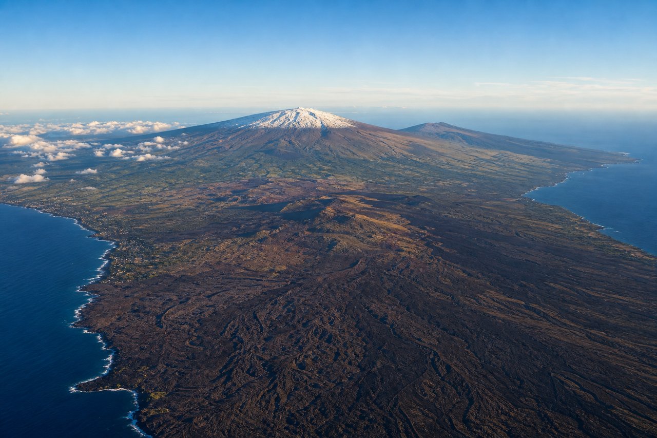
Takeoff from KOA
LEFTLeft side captures the dramatic volcanic coastline of the Kona coast during initial climb, with the Pacific Ocean and the western flank of Mauna Loa visible. Right side faces inland toward the volcanic plateau with less immediate visual interest.
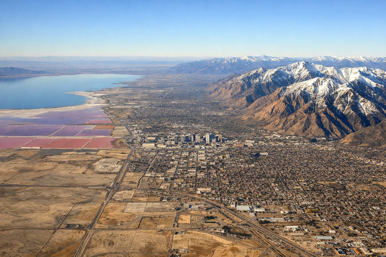
Landing at SLC
RIGHTRight side provides superior views during approach to SLC, with the Wasatch Range dominating the eastern approach corridor. The dramatic north-south oriented mountains frame the descent into the Salt Lake Valley, and the Great Salt Lake becomes visible on the left side of the aircraft during final approach.
Landmarks on this routeAll landmarks →
Will your flight be in sunlight?
See exactly which side of the plane gets sun and shade at your departure time.
About This Route
Which side of the plane should I sit on flying from Kona International At Keahole (KOA) to Salt Lake City International (SLC)?
Sit on the Right side of the plane for the best views on flights from Kona to Salt Lake City. While the Kona departure offers scenic volcanic coastline, the SLC landing provides far more dramatic and sustained mountain scenery. The Wasatch Range approach is one of the most visually striking arrivals in the western US, with high peaks framing the descent and the Great Salt Lake adding geographic variety. The cruise phase over the interior US offers moderate interest but lacks the visual drama of either endpoint, making the landing experience the decisive factor.
What can I see during takeoff from Kona International At Keahole in Kona?
During takeoff from Kona International At Keahole (KOA), sit on the Left side for the best views. Left side captures the dramatic volcanic coastline of the Kona coast during initial climb, with the Pacific Ocean and the western flank of Mauna Loa visible. Right side faces inland toward the volcanic plateau with less immediate visual interest. Notable sights include: Kona coastline with dark lava fields, Mauna Loa's western slope, Pacific Ocean horizon, Keahole Point.
What can I see when landing at Salt Lake City International in Salt Lake City?
When landing at Salt Lake City International (SLC), sit on the Right side for the best views. Right side provides superior views during approach to SLC, with the Wasatch Range dominating the eastern approach corridor. The dramatic north-south oriented mountains frame the descent into the Salt Lake Valley, and the Great Salt Lake becomes visible on the left side of the aircraft during final approach. Notable sights include: Wasatch Range peaks, Great Salt Lake, Salt Lake Valley floor, Oquirrh Mountains to the west.
How long is the flight from Kona to Salt Lake City?
The flight from Kona International At Keahole (KOA) to Salt Lake City International (SLC) takes 5h 45m.
What does the Kona to Salt Lake City flight path pass over?
The flight path crosses the Colorado Plateau and Great Basin. Notable features visible during cruise include the San Juan Mountains of southwestern Colorado (if routed south of direct), the Book Cliffs along the Utah-Colorado border, and the vast high desert of central Utah with its sparse vegetation and subtle topographic relief. The flight typically maintains 35,000-37,000 feet, making individual landmarks appear small, but the broad sweep of the Rocky Mountain system and the transition from volcanic Hawaii to the arid interior creates geographic variety.