Left side scores higher due to the dramatic Wasatch Range departure from SLC (3.5 points for takeoff scenery) combined with a respectable cruise phase over the Great Basin and Pacific. Although the landing at Kona favors the right side (2.5 points), the exceptional takeoff experience and the full-flight balance give left the edge. Right side's landing advantage (3.0 points) does not fully compensate for a less dramatic departure and a long cruise phase dominated by open ocean (max 2.0 for ocean-only segments). Left window provides more varied and memorable scenery across the complete flight.
Flight Path
Great Basin desert floor (Nevada and Utah), Sierra Nevada range to the west (visible on clear days), transition to open Pacific Ocean approximately 800 miles west of California coast, no significant landmarks over mid-Pacific, approach to Hawaiian Islands with Big Island's volcanic profile visible 50+ miles out
Great circle distance and headings ›


Phase by phase
Takeoff from SLC
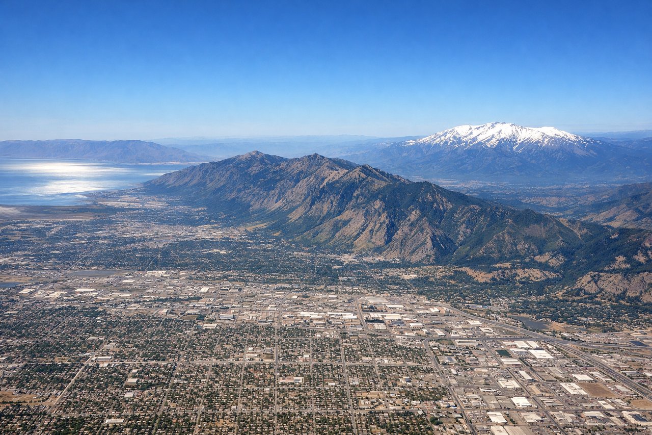
LEFTLeft side captures the Wasatch Range immediately east of SLC during northbound departure (runway 16), with dramatic peaks rising 6,000–8,000 feet above the valley floor. Right side faces west toward the Oquirrh Mountains and the Great Salt Lake, which are lower relief and less visually striking during climb-out.
Landing at KOA
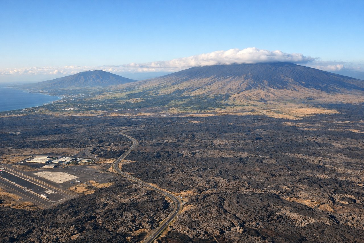
RIGHTRight side offers the superior arrival experience on Kona's typical runway 17 (northbound landing). Passengers descend over the Kona coast with views of the volcanic slopes of Hualalai, the turquoise Pacific, and the Kona town waterfront. Left side faces inland over the barren lava fields and interior slopes, which are visually monotonous.
Landmarks on this routeAll landmarks →
Will your flight be in sunlight?
See exactly which side of the plane gets sun and shade at your departure time.
About This Route
Which side of the plane should I sit on flying from Salt Lake City International (SLC) to Kona International At Keahole (KOA)?
Sit on the Left side of the plane for the best views on flights from Salt Lake City to Kona. Left side scores higher due to the dramatic Wasatch Range departure from SLC (3.5 points for takeoff scenery) combined with a respectable cruise phase over the Great Basin and Pacific. Although the landing at Kona favors the right side (2.5 points), the exceptional takeoff experience and the full-flight balance give left the edge. Right side's landing advantage (3.0 points) does not fully compensate for a less dramatic departure and a long cruise phase dominated by open ocean (max 2.0 for ocean-only segments). Left window provides more varied and memorable scenery across the complete flight.
What can I see during takeoff from Salt Lake City International in Salt Lake City?
During takeoff from Salt Lake City International (SLC), sit on the Left side for the best views. Left side captures the Wasatch Range immediately east of SLC during northbound departure (runway 16), with dramatic peaks rising 6,000–8,000 feet above the valley floor. Right side faces west toward the Oquirrh Mountains and the Great Salt Lake, which are lower relief and less visually striking during climb-out. Notable sights include: Wasatch Range peaks (including Mount Olympus and Lone Peak), Salt Lake City downtown skyline, Utah Lake to the south.
What can I see when landing at Kona International At Keahole in Kona?
When landing at Kona International At Keahole (KOA), sit on the Right side for the best views. Right side offers the superior arrival experience on Kona's typical runway 17 (northbound landing). Passengers descend over the Kona coast with views of the volcanic slopes of Hualalai, the turquoise Pacific, and the Kona town waterfront. Left side faces inland over the barren lava fields and interior slopes, which are visually monotonous. Notable sights include: Hualalai volcano's western slopes, Kona coast and harbor, turquoise Pacific waters, Kona town beachfront.
How long is the flight from Salt Lake City to Kona?
The flight from Salt Lake City International (SLC) to Kona International At Keahole (KOA) takes 5h 15m.
What does the Salt Lake City to Kona flight path pass over?
Great Basin desert floor (Nevada and Utah), Sierra Nevada range to the west (visible on clear days), transition to open Pacific Ocean approximately 800 miles west of California coast, no significant landmarks over mid-Pacific, approach to Hawaiian Islands with Big Island's volcanic profile visible 50+ miles out