Left side delivers the two best moments of the flight: the Tokyo Bay and Mount Fuji view on departure, and the spectacular Great Barrier Reef lagoon colors on approach into Cairns. The right side offers the Pacific Ocean for most of the flight, which is featureless open water.
Flight Path
The flight tracks south-southeast over the Philippine Sea, passing east of the Philippines and Luzon, then crosses the Coral Sea north of Papua New Guinea. Passengers may glimpse the northern tip of Luzon or the island chains of the Philippines on the right side at cruise altitude if routing passes close enough. The Torres Strait and Cape York Peninsula of Australia's far north are sometimes visible on descent. Much of the overwater portion crosses the deep blue Philippine Sea and Coral Sea with no land in sight.
Great circle distance and headings ›

Phase by phase
Takeoff from NRT
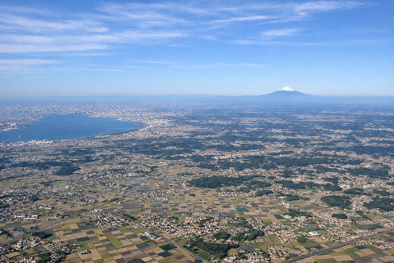
LEFTNRT's primary departure runways (34L/34R) head roughly northward, meaning a left-seat passenger faces west toward Tokyo Bay and the Kanto Plain. You get a clear view of Tokyo Bay's broad expanse and, on clear days, Mount Fuji rising above the Kanto Plain to the southwest. The right side faces east over the Pacific with little to see.
Landing at CNS
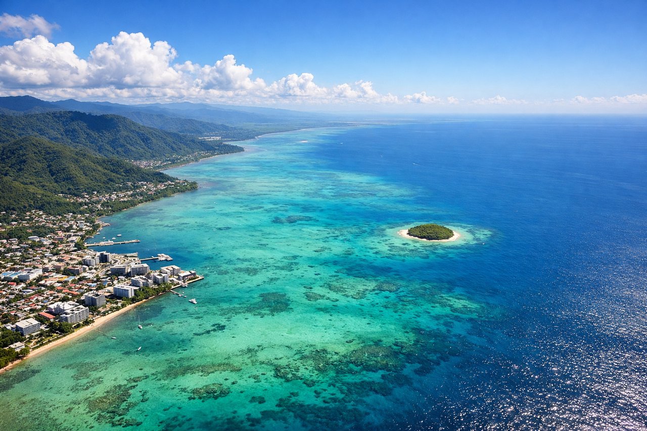
LEFTCairns typically uses runway 15 for southerly arrivals, meaning the aircraft approaches from the north-northwest over the Coral Sea. A left-seat passenger faces east toward the Great Barrier Reef lagoon and the Coral Sea, where the shallow turquoise reef waters and coral formations are clearly visible from altitude. The right side faces inland over the dense rainforest of the Atherton Tablelands.
Landmarks on this routeAll landmarks →
Will your flight be in sunlight?
See exactly which side of the plane gets sun and shade at your departure time.
About This Route
Which side of the plane should I sit on flying from New Tokyo International (NRT) to Cairns International (CNS)?
Sit on the Left side of the plane for the best views on flights from Tokyo to Cairns. Left side delivers the two best moments of the flight: the Tokyo Bay and Mount Fuji view on departure, and the spectacular Great Barrier Reef lagoon colors on approach into Cairns. The right side offers the Pacific Ocean for most of the flight, which is featureless open water.
What can I see during takeoff from New Tokyo International in Tokyo?
During takeoff from New Tokyo International (NRT), sit on the Left side for the best views. NRT's primary departure runways (34L/34R) head roughly northward, meaning a left-seat passenger faces west toward Tokyo Bay and the Kanto Plain. You get a clear view of Tokyo Bay's broad expanse and, on clear days, Mount Fuji rising above the Kanto Plain to the southwest. The right side faces east over the Pacific with little to see. Notable sights include: Tokyo Bay, Mount Fuji (on clear days, ~100km southwest), Kanto Plain urban sprawl, Boso Peninsula coastline.
What can I see when landing at Cairns International in Cairns?
When landing at Cairns International (CNS), sit on the Left side for the best views. Cairns typically uses runway 15 for southerly arrivals, meaning the aircraft approaches from the north-northwest over the Coral Sea. A left-seat passenger faces east toward the Great Barrier Reef lagoon and the Coral Sea, where the shallow turquoise reef waters and coral formations are clearly visible from altitude. The right side faces inland over the dense rainforest of the Atherton Tablelands. Notable sights include: Great Barrier Reef lagoon (turquoise shallow water), Trinity Bay, Green Island (coral cay visible as a small green dot), Coral Sea.
How long is the flight from Tokyo to Cairns?
The flight from New Tokyo International (NRT) to Cairns International (CNS) takes Approximately 8 to 9 hours.
What does the Tokyo to Cairns flight path pass over?
The flight tracks south-southeast over the Philippine Sea, passing east of the Philippines and Luzon, then crosses the Coral Sea north of Papua New Guinea. Passengers may glimpse the northern tip of Luzon or the island chains of the Philippines on the right side at cruise altitude if routing passes close enough. The Torres Strait and Cape York Peninsula of Australia's far north are sometimes visible on descent. Much of the overwater portion crosses the deep blue Philippine Sea and Coral Sea with no land in sight.