The left side strings together the most memorable sights of the whole route: Tokyo's skyline and a chance of Mount Fuji at departure, glimpses of Alaska's coastal ranges during the northern great-circle cruise, and the dramatic Mount Rainier and Seattle skyline on arrival, while the right side faces mostly open ocean and the lower Olympic range.
Flight Path
Tokyo to Seattle is 4,757 miles (7,655 km), a flight of about 9 hours 40 minutes.
North Pacific Ocean with a great-circle track passing south of the Kuril Islands and Kamchatka Peninsula, then near the Aleutian Islands and Alaska Peninsula, across the Gulf of Alaska, and down the mountainous coastline of British Columbia before descending into Puget Sound.
Great circle distance and headings ›

Phase by phase
Takeoff from NRT
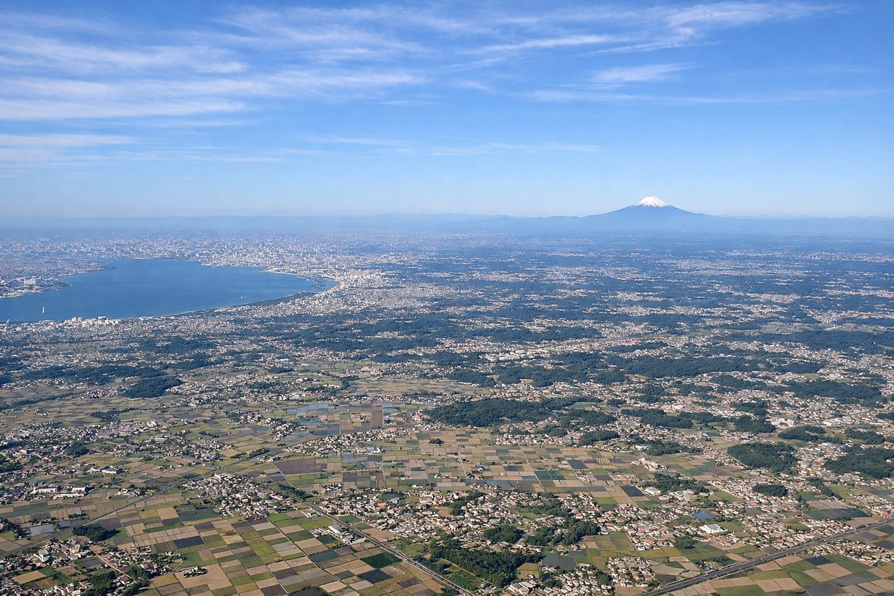
LEFTDeparting Narita, the left side faces inland toward Tokyo Bay and the vast Tokyo-Chiba urban sprawl, with Mount Fuji sometimes visible as a distant cone to the southwest on clear days. The right side only shows open farmland and then the featureless Pacific.
Landing at SEA
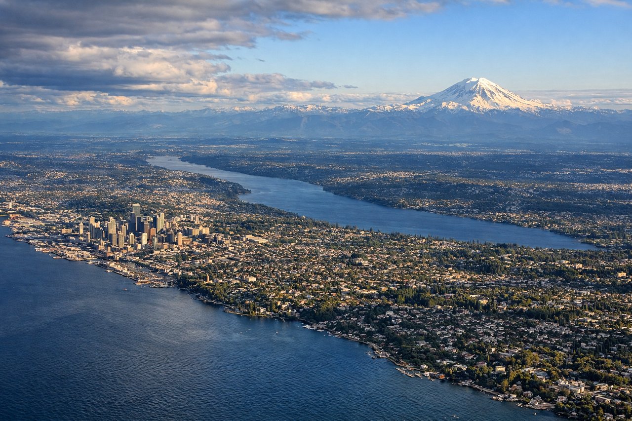
LEFTOn the approach into Sea-Tac from the north over Puget Sound, the left side faces east toward the Cascade Range, giving passengers a straight-on view of Mount Rainier's massive snow-covered summit along with the Seattle skyline and Lake Washington. The right side only shows the lower, less dramatic Olympic Mountains and open water.
Landmarks on this routeAll landmarks →
Will your flight be in sunlight?
Pick a date and time in the Sun Map to watch the sun move across your whole flight.
About This Route
Which side of the plane should I sit on flying from New Tokyo International (NRT) to Seattle Tacoma International (SEA)?
Sit on the Left side of the plane for the best views on flights from Tokyo to Seattle. The left side strings together the most memorable sights of the whole route: Tokyo's skyline and a chance of Mount Fuji at departure, glimpses of Alaska's coastal ranges during the northern great-circle cruise, and the dramatic Mount Rainier and Seattle skyline on arrival, while the right side faces mostly open ocean and the lower Olympic range.
What can I see during takeoff from New Tokyo International in Tokyo?
During takeoff from New Tokyo International (NRT), sit on the Left side for the best views. Departing Narita, the left side faces inland toward Tokyo Bay and the vast Tokyo-Chiba urban sprawl, with Mount Fuji sometimes visible as a distant cone to the southwest on clear days. The right side only shows open farmland and then the featureless Pacific. Notable sights include: Tokyo Bay, Tokyo/Chiba skyline, Mount Fuji (distant), Boso Peninsula coastline.
What can I see when landing at Seattle Tacoma International in Seattle?
When landing at Seattle Tacoma International (SEA), sit on the Left side for the best views. On the approach into Sea-Tac from the north over Puget Sound, the left side faces east toward the Cascade Range, giving passengers a straight-on view of Mount Rainier's massive snow-covered summit along with the Seattle skyline and Lake Washington. The right side only shows the lower, less dramatic Olympic Mountains and open water. Notable sights include: Mount Rainier, Cascade Range, Seattle downtown skyline, Lake Washington.
How long is the flight from Tokyo to Seattle?
The flight from New Tokyo International (NRT) to Seattle Tacoma International (SEA) takes about 9 hours 40 minutes. The shortest flight path between them is 4,757 miles (7,655 km); winds and air traffic control usually add a few percent.
What does the Tokyo to Seattle flight path pass over?
North Pacific Ocean with a great-circle track passing south of the Kuril Islands and Kamchatka Peninsula, then near the Aleutian Islands and Alaska Peninsula, across the Gulf of Alaska, and down the mountainous coastline of British Columbia before descending into Puget Sound.