Right side wins for the complete journey. Departure offers unobstructed views of Ecuador's volcanic Andes, and the southbound routing keeps the Andes cordillera on the right for most of the flight. While landing favors left, the extended climb-out and cruise segments over the Andes spine make right-side seats the better overall choice.
Flown UIO to SCL? Did we get it right?
Flight Path
Quito to Santiago is 2,351 miles (3,783 km), a flight of about 5 hours 5 minutes.
The flight path follows the Interandean Valley southbound, staying near the Andes cordillera spine. Notable features include: Cotopaxi and Tungurahua volcanoes (Ecuador), the Peru-Ecuador border region with high-altitude plateaus, the Peruvian Andes including peaks near Arequipa, and the transition into Chilean territory with the Atacama Desert to the west and the Central Chilean Andes to the east. The cordillera remains visible on the right throughout most of cruise, with the western desert plains visible on the left during the southern portion of the flight.
Great circle distance and headings ›


Phase by phase
Takeoff from UIO
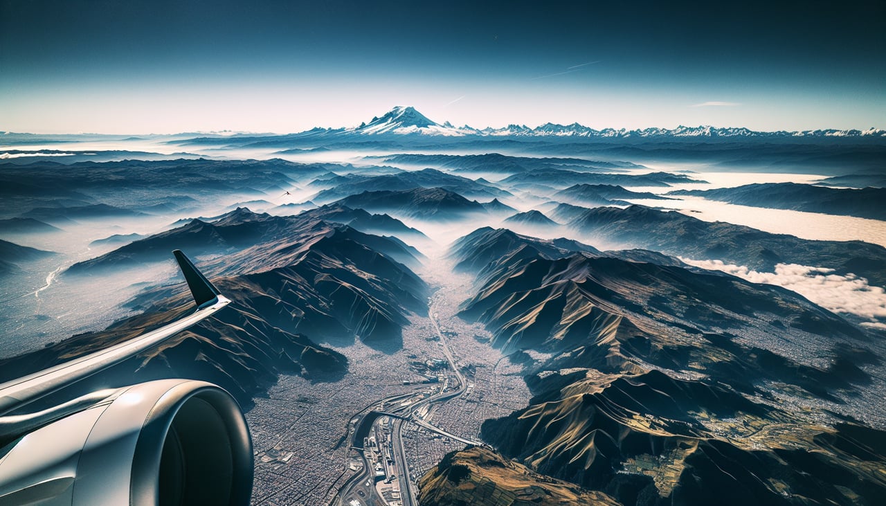
RIGHTRight side captures the Cordillera Occidental (Western Andes) immediately after departure, with Quito's urban sprawl visible below. Mariscal Sucre typically departs northbound (Runway 09L/27R or 09R/27L), so right-side seats face west toward the dramatic volcanic peaks that define the climb-out corridor.
Landing at SCL
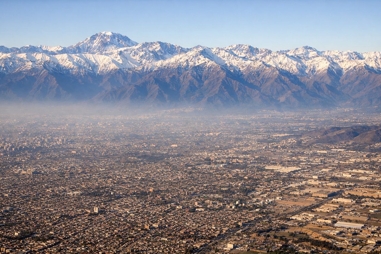
LEFTLeft side provides the best approach view into Santiago. Aircraft typically land on Runway 07L/25R or 07R/25L (eastbound preferred). Left-side seats face north and west during descent, capturing the Andes cordillera backdrop and the sprawling Santiago metropolitan area with the Mapocho River visible through the urban grid.
Will your flight be in sunlight?
Pick a date and time in the Sun Map to watch the sun move across your whole flight.
About This Route
Which side of the plane should I sit on flying from Mariscal Sucre International Airport (UIO) to Arturo Merino Benitez International (SCL)?
Sit on the Right side of the plane for the best views on flights from Quito to Santiago. Right side wins for the complete journey. Departure offers unobstructed views of Ecuador's volcanic Andes, and the southbound routing keeps the Andes cordillera on the right for most of the flight. While landing favors left, the extended climb-out and cruise segments over the Andes spine make right-side seats the better overall choice.
What can I see during takeoff from Mariscal Sucre International Airport in Quito?
During takeoff from Mariscal Sucre International Airport (UIO), sit on the Right side for the best views. Right side captures the Cordillera Occidental (Western Andes) immediately after departure, with Quito's urban sprawl visible below. Mariscal Sucre typically departs northbound (Runway 09L/27R or 09R/27L), so right-side seats face west toward the dramatic volcanic peaks that define the climb-out corridor. Notable sights include: Cordillera Occidental peaks (Pichincha, Cotopaxi visible in distance), Quito urban grid and surrounding high-altitude valleys, Interandean Valley floor, volcanic cones dotting the western escarpment.
What can I see when landing at Arturo Merino Benitez International in Santiago?
When landing at Arturo Merino Benitez International (SCL), sit on the Left side for the best views. Left side provides the best approach view into Santiago. Aircraft typically land on Runway 07L/25R or 07R/25L (eastbound preferred). Left-side seats face north and west during descent, capturing the Andes cordillera backdrop and the sprawling Santiago metropolitan area with the Mapocho River visible through the urban grid. Notable sights include: Andes cordillera (snow-capped peaks including Aconcagua massif on distant horizon), Santiago metropolitan area with Mapocho River, Cerro San Cristóbal and Cerro Santa Lucía (urban landmarks), Arturo Merino Benítez airport runways and surrounding industrial zones.
How long is the flight from Quito to Santiago?
The flight from Mariscal Sucre International Airport (UIO) to Arturo Merino Benitez International (SCL) takes about 5 hours 5 minutes. The shortest flight path between them is 2,351 miles (3,783 km); winds and air traffic control usually add a few percent.
What does the Quito to Santiago flight path pass over?
The flight path follows the Interandean Valley southbound, staying near the Andes cordillera spine. Notable features include: Cotopaxi and Tungurahua volcanoes (Ecuador), the Peru-Ecuador border region with high-altitude plateaus, the Peruvian Andes including peaks near Arequipa, and the transition into Chilean territory with the Atacama Desert to the west and the Central Chilean Andes to the east. The cordillera remains visible on the right throughout most of cruise, with the western desert plains visible on the left during the southern portion of the flight.