The right side wins overall because the long Siberian cruise segment reveals the Altai and Sayan ranges and the Lake Baikal region to the south of the flight path, along with the Kazakh steppe and Gobi desert fringes — a much more varied and dramatic sequence than the flatter taiga and river plains visible to the north on the left.
Flown WAW to NRT? Did we get it right?
Flight Path
Warsaw to Tokyo is 5,352 miles (8,613 km), a flight of about 10 hours 15 minutes.
The Ural Mountains marking the Europe-Asia divide, the West Siberian Plain with the Ob River, the Altai and Sayan mountains near Lake Baikal, and the steppe and desert fringes of Mongolia before the descent toward the Sea of Japan.
Great circle distance and headings ›

Phase by phase
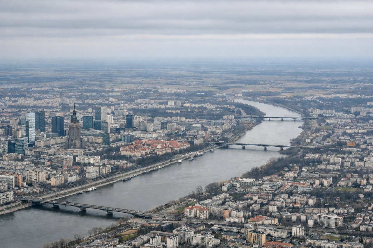
Takeoff from WAW
RIGHTDeparting WAW on runway 29 into the prevailing westerly wind, the aircraft typically banks right to intercept its eastbound routing, putting Warsaw's city center directly below on the right side. Passengers get a brief but clear look at the Vistula River and the downtown skyline before the plains take over.
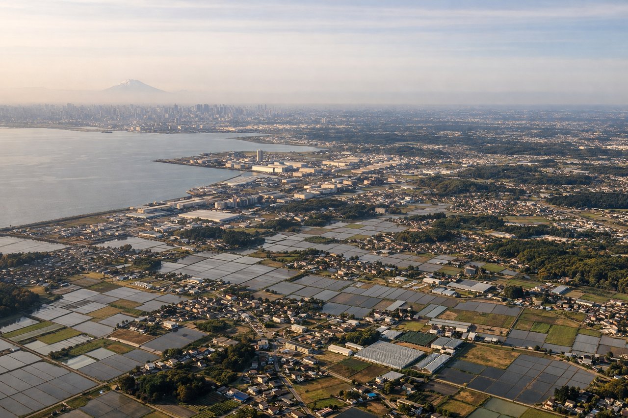
Landing at NRT
LEFTOn approach to Narita landing north into a headwind, the aircraft swings out over Tokyo Bay before lining up, giving left-side passengers a wide view of the Tokyo waterfront skyline with Mount Fuji's distinctive cone visible on the horizon to the southwest on clear days.
Will your flight be in sunlight?
Pick a date and time in the Sun Map to watch the sun move across your whole flight.
About This Route
Which side of the plane should I sit on flying from Okecie (WAW) to New Tokyo International (NRT)?
Sit on the Right side of the plane for the best views on flights from Warsaw to Tokyo. The right side wins overall because the long Siberian cruise segment reveals the Altai and Sayan ranges and the Lake Baikal region to the south of the flight path, along with the Kazakh steppe and Gobi desert fringes — a much more varied and dramatic sequence than the flatter taiga and river plains visible to the north on the left.
What can I see during takeoff from Okecie in Warsaw?
During takeoff from Okecie (WAW), sit on the Right side for the best views. Departing WAW on runway 29 into the prevailing westerly wind, the aircraft typically banks right to intercept its eastbound routing, putting Warsaw's city center directly below on the right side. Passengers get a brief but clear look at the Vistula River and the downtown skyline before the plains take over. Notable sights include: Vistula River bends, Warsaw skyline (Palace of Culture and Science), Praga district rooftops, Łazienki Park greenery.
What can I see when landing at New Tokyo International in Tokyo?
When landing at New Tokyo International (NRT), sit on the Left side for the best views. On approach to Narita landing north into a headwind, the aircraft swings out over Tokyo Bay before lining up, giving left-side passengers a wide view of the Tokyo waterfront skyline with Mount Fuji's distinctive cone visible on the horizon to the southwest on clear days. Notable sights include: Mount Fuji (distant horizon), Tokyo Bay and waterfront skyline, Boso Peninsula coastline, Chiba prefecture farmland.
How long is the flight from Warsaw to Tokyo?
The flight from Okecie (WAW) to New Tokyo International (NRT) takes about 10 hours 15 minutes. The shortest flight path between them is 5,352 miles (8,613 km); winds and air traffic control usually add a few percent.
What does the Warsaw to Tokyo flight path pass over?
The Ural Mountains marking the Europe-Asia divide, the West Siberian Plain with the Ob River, the Altai and Sayan mountains near Lake Baikal, and the steppe and desert fringes of Mongolia before the descent toward the Sea of Japan.