Vancouver to Juneau is 783 miles (1,260 km), a flight of about 2 hours 15 minutes.
While takeoff favors the left, the landing approach to Juneau—the primary visual highlight of this route—strongly favors right-side seats. The descent into Juneau's glacier-surrounded valley is the signature view of this flight, and right seats capture the Chilkat Mountains and Mendenhall Glacier approach directly.
Flight Path
The flight path follows the Inside Passage northbound, passing over the BC Inside Passage with numerous islands (Pender, Hornby, Cormorant), then transitions to Alaskan waters. Notable midpoint features include the Clarence Strait area and the approach to Juneau's narrow valley. The route stays over water for most of the journey, with the coastline visible to the east (right side) throughout—a continuous view of the temperate rainforest coastline and its numerous inlets and fjords.
Great circle distance and headings ›


Phase by phase
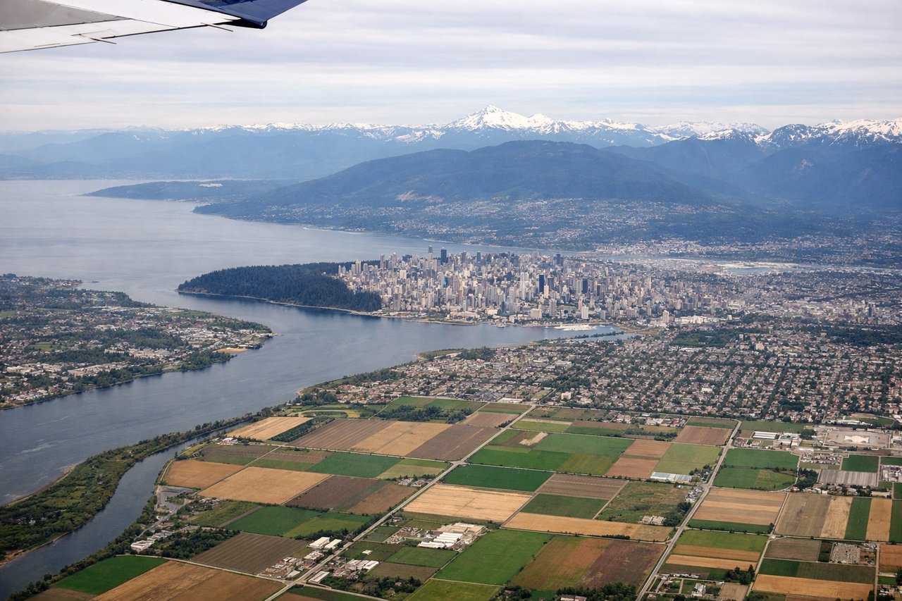
Takeoff from YVR
LEFTYVR typically departs northbound (runways 26L/R or 08L/R depending on wind). Left seats face west-northwest during initial climb, providing views of the North Shore Mountains and the Georgia Strait coastline as you gain altitude over water.
Landing at JNU
RIGHTApproach to JNU typically uses runway 08 or 26 depending on wind. Right-side seats during descent offer views of the Chilkat Mountains, Gastineau Channel, and the dramatic glaciated peaks surrounding Juneau's narrow valley approach.
Landmarks on this routeAll landmarks →
Will your flight be in sunlight?
Pick a date and time in the Sun Map to watch the sun move across your whole flight.
About This Route
Which side of the plane should I sit on flying from Vancouver International (YVR) to Juneau International (JNU)?
Sit on the Right side of the plane for the best views on flights from Vancouver to Juneau. While takeoff favors the left, the landing approach to Juneau—the primary visual highlight of this route—strongly favors right-side seats. The descent into Juneau's glacier-surrounded valley is the signature view of this flight, and right seats capture the Chilkat Mountains and Mendenhall Glacier approach directly.
What can I see during takeoff from Vancouver International in Vancouver?
During takeoff from Vancouver International (YVR), sit on the Left side for the best views. YVR typically departs northbound (runways 26L/R or 08L/R depending on wind). Left seats face west-northwest during initial climb, providing views of the North Shore Mountains and the Georgia Strait coastline as you gain altitude over water. Notable sights include: North Shore Mountains (Grouse, Seymour peaks), Georgia Strait, Bowen Island, Howe Sound.
What can I see when landing at Juneau International in Juneau?
When landing at Juneau International (JNU), sit on the Right side for the best views. Approach to JNU typically uses runway 08 or 26 depending on wind. Right-side seats during descent offer views of the Chilkat Mountains, Gastineau Channel, and the dramatic glaciated peaks surrounding Juneau's narrow valley approach. Notable sights include: Chilkat Mountains, Gastineau Channel, Mendenhall Glacier, Juneau's downtown waterfront.
How long is the flight from Vancouver to Juneau?
The flight from Vancouver International (YVR) to Juneau International (JNU) takes about 2 hours 15 minutes. The shortest flight path between them is 783 miles (1,260 km); winds and air traffic control usually add a few percent.
What does the Vancouver to Juneau flight path pass over?
The flight path follows the Inside Passage northbound, passing over the BC Inside Passage with numerous islands (Pender, Hornby, Cormorant), then transitions to Alaskan waters. Notable midpoint features include the Clarence Strait area and the approach to Juneau's narrow valley. The route stays over water for most of the journey, with the coastline visible to the east (right side) throughout—a continuous view of the temperate rainforest coastline and its numerous inlets and fjords.