The takeoff view from YVR is significantly more dramatic, with the North Shore Mountains and Burrard Inlet providing strong visual interest. The landing at YKF is relatively flat and agricultural. Left seats capture the most memorable portion of this route.
Flight Path
The flight path crosses the Canadian Shield and Great Lakes region. Notable geographic transitions include: the Rocky Mountain foothills (visible from altitude around 1.5 hours out of YVR), the prairies of Alberta and Saskatchewan (flat, featureless at cruise), the transition into the Canadian Shield near the Ontario border (forests and lakes become visible), and the approach to the Great Lakes basin with increasing urbanization around the Golden Horseshoe region.
Great circle distance and headings ›
.jpg?width=600)


Phase by phase
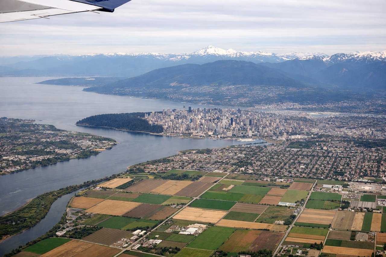
Takeoff from YVR
LEFTYVR typically departs runways 26L/26R (westbound) or 08L/08R (eastbound). Westbound departures favor left seats for views of the North Shore Mountains and Burrard Inlet. Eastbound departures favor left seats for the Fraser River delta and suburban sprawl eastward.
Landing at YKF
RIGHTWaterloo Regional Airport (YKF) sits in southwestern Ontario with runways oriented roughly 09/27. Approach vectors typically come from the west or northwest. Right-side seats capture the Grand River valley, agricultural patchwork, and the Kitchener-Waterloo urban area during descent.
Landmarks on this routeAll landmarks →
Will your flight be in sunlight?
See exactly which side of the plane gets sun and shade at your departure time.
About This Route
Which side of the plane should I sit on flying from Vancouver International (YVR) to Waterloo Rgnl (YKF)?
Sit on the Left side of the plane for the best views on flights from Vancouver to Waterloo. The takeoff view from YVR is significantly more dramatic, with the North Shore Mountains and Burrard Inlet providing strong visual interest. The landing at YKF is relatively flat and agricultural. Left seats capture the most memorable portion of this route.
What can I see during takeoff from Vancouver International in Vancouver?
During takeoff from Vancouver International (YVR), sit on the Left side for the best views. YVR typically departs runways 26L/26R (westbound) or 08L/08R (eastbound). Westbound departures favor left seats for views of the North Shore Mountains and Burrard Inlet. Eastbound departures favor left seats for the Fraser River delta and suburban sprawl eastward. Notable sights include: North Shore Mountains (Coast Range), Burrard Inlet, Fraser River delta, Vancouver city grid.
What can I see when landing at Waterloo Rgnl in Waterloo?
When landing at Waterloo Rgnl (YKF), sit on the Right side for the best views. Waterloo Regional Airport (YKF) sits in southwestern Ontario with runways oriented roughly 09/27. Approach vectors typically come from the west or northwest. Right-side seats capture the Grand River valley, agricultural patchwork, and the Kitchener-Waterloo urban area during descent. Notable sights include: Grand River valley, Kitchener-Waterloo urban area, agricultural fields (checkerboard pattern), Lake Ontario (distant, on horizon).
How long is the flight from Vancouver to Waterloo?
The flight from Vancouver International (YVR) to Waterloo Rgnl (YKF) takes Approximately 4 hours 45 minutes.
What does the Vancouver to Waterloo flight path pass over?
The flight path crosses the Canadian Shield and Great Lakes region. Notable geographic transitions include: the Rocky Mountain foothills (visible from altitude around 1.5 hours out of YVR), the prairies of Alberta and Saskatchewan (flat, featureless at cruise), the transition into the Canadian Shield near the Ontario border (forests and lakes become visible), and the approach to the Great Lakes basin with increasing urbanization around the Golden Horseshoe region.