The left (west-facing) side captures the dramatic Coast Mountains during climb-out and continues to offer more varied terrain — river valleys, forested plateau, and distant peaks — through cruise and descent, while the right side stays comparatively flat and repetitive over the Interior Plateau.
Flown YVR to YXS? Did we get it right?
Flight Path
Vancouver to Prince George is 325 miles (523 km), a flight of about 55 minutes.
Fraser Plateau, Cariboo Mountains foothills, Quesnel River valley, patches of interior boreal forest and logging clearings
Great circle distance and headings ›Phase by phase
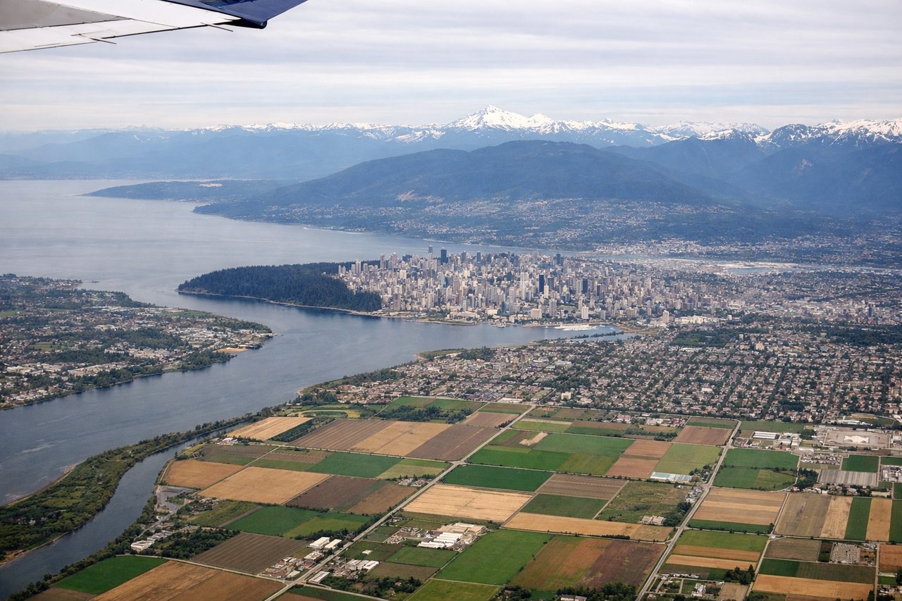
Takeoff from YVR
LEFTDeparting YVR and turning north toward Prince George, the left side faces west toward the Coast Mountains and the Howe Sound/Garibaldi corridor, offering jagged glaciated peaks right after takeoff. The right side mostly shows the flatter Fraser Valley and suburban sprawl.
Landing at YXS
LEFTOn approach into YXS from the south along the Fraser River corridor, the left side gives better views of the Fraser River's braided channels and the rolling Cariboo Plateau forestland as the plane descends. The right side is dominated by flat plateau farmland with fewer distinguishing features.
Will your flight be in sunlight?
Pick a date and time in the Sun Map to watch the sun move across your whole flight.
About This Route
Which side of the plane should I sit on flying from Vancouver International (YVR) to Prince George (YXS)?
Sit on the Left side of the plane for the best views on flights from Vancouver to Prince George. The left (west-facing) side captures the dramatic Coast Mountains during climb-out and continues to offer more varied terrain — river valleys, forested plateau, and distant peaks — through cruise and descent, while the right side stays comparatively flat and repetitive over the Interior Plateau.
What can I see during takeoff from Vancouver International in Vancouver?
During takeoff from Vancouver International (YVR), sit on the Left side for the best views. Departing YVR and turning north toward Prince George, the left side faces west toward the Coast Mountains and the Howe Sound/Garibaldi corridor, offering jagged glaciated peaks right after takeoff. The right side mostly shows the flatter Fraser Valley and suburban sprawl. Notable sights include: Coast Mountains, Tantalus Range, Howe Sound, Garibaldi Provincial Park peaks.
What can I see when landing at Prince George in Prince George?
When landing at Prince George (YXS), sit on the Left side for the best views. On approach into YXS from the south along the Fraser River corridor, the left side gives better views of the Fraser River's braided channels and the rolling Cariboo Plateau forestland as the plane descends. The right side is dominated by flat plateau farmland with fewer distinguishing features. Notable sights include: Fraser River, Cariboo Plateau forests, Nechako River confluence, Prince George city outskirts.
How long is the flight from Vancouver to Prince George?
The flight from Vancouver International (YVR) to Prince George (YXS) takes about 55 minutes. The shortest flight path between them is 325 miles (523 km); winds and air traffic control usually add a few percent.
What does the Vancouver to Prince George flight path pass over?
Fraser Plateau, Cariboo Mountains foothills, Quesnel River valley, patches of interior boreal forest and logging clearings