The left side wins both the takeoff and landing segments — Seoul's skyline on departure and Mount Fuji plus Yokohama on arrival — giving it much stronger landmark density and visual drama than the right side's flat coastal mudflats and Chiba industrial shoreline.
Flown ICN to HND? Did we get it right?
Flight Path
Seoul to Tokyo is 752 miles (1,210 km), a flight of about 2 hours 20 minutes.
Korea Strait and Tsushima Island, followed by the mountainous coastline of western Honshu and the Seto Inland Sea region before descending toward Tokyo Bay
Great circle distance and headings ›

Phase by phase
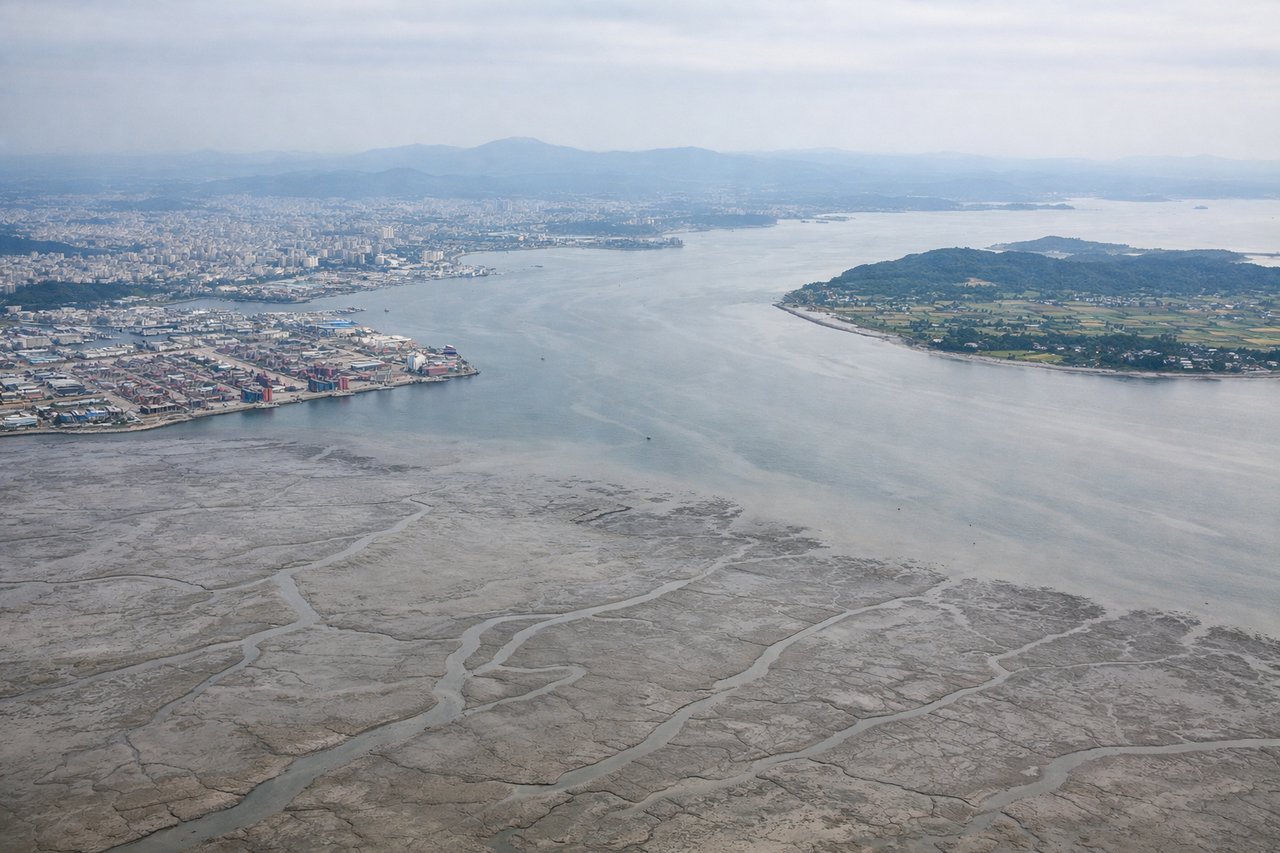
Takeoff from ICN
LEFTDeparting ICN on the southeast-heading runways puts Seoul's skyline, the Han River, and the dense Incheon-Seoul urban corridor on the left side as the aircraft climbs away. The right side only shows the flat tidal mudflats and islands of the Yellow Sea, which are far less distinctive.
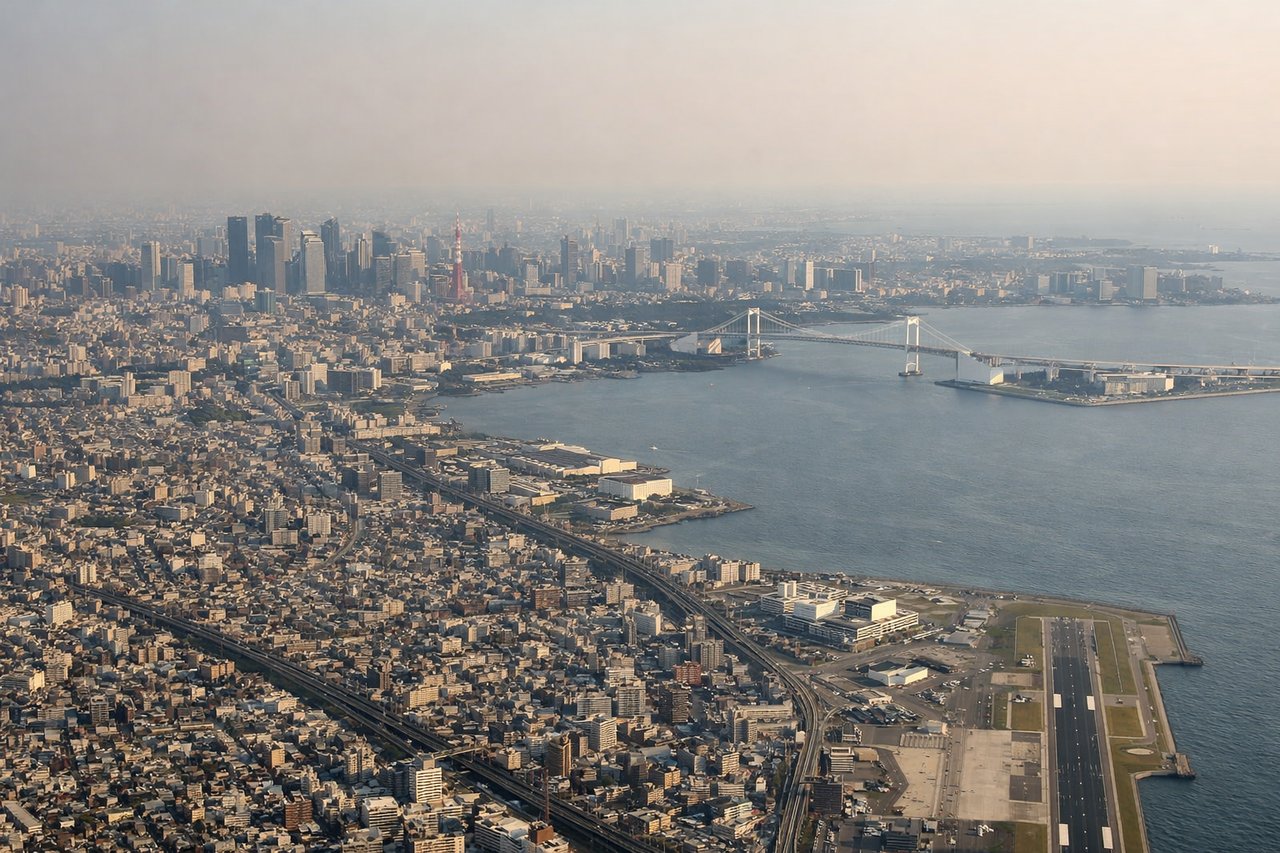
Landing at HND
LEFTOn the common south-wind arrival into Haneda, planes cross Tokyo Bay heading north, and the left side faces west toward Yokohama's dense waterfront skyline and, on clear days, Mount Fuji's distinctive cone on the horizon. The right side only offers the flatter, industrial Chiba coastline and Boso Peninsula.
Will your flight be in sunlight?
Pick a date and time in the Sun Map to watch the sun move across your whole flight.
About This Route
Which side of the plane should I sit on flying from Incheon International (ICN) to Tokyo International (HND)?
Sit on the Left side of the plane for the best views on flights from Seoul to Tokyo. The left side wins both the takeoff and landing segments — Seoul's skyline on departure and Mount Fuji plus Yokohama on arrival — giving it much stronger landmark density and visual drama than the right side's flat coastal mudflats and Chiba industrial shoreline.
What can I see during takeoff from Incheon International in Seoul?
During takeoff from Incheon International (ICN), sit on the Left side for the best views. Departing ICN on the southeast-heading runways puts Seoul's skyline, the Han River, and the dense Incheon-Seoul urban corridor on the left side as the aircraft climbs away. The right side only shows the flat tidal mudflats and islands of the Yellow Sea, which are far less distinctive. Notable sights include: Seoul skyline, Han River, Incheon metropolitan sprawl, Yellow Sea tidal islands (right side, minor).
What can I see when landing at Tokyo International in Tokyo?
When landing at Tokyo International (HND), sit on the Left side for the best views. On the common south-wind arrival into Haneda, planes cross Tokyo Bay heading north, and the left side faces west toward Yokohama's dense waterfront skyline and, on clear days, Mount Fuji's distinctive cone on the horizon. The right side only offers the flatter, industrial Chiba coastline and Boso Peninsula. Notable sights include: Mount Fuji, Yokohama skyline (Minato Mirai), Tokyo Bay shipping lanes, Kawasaki industrial waterfront.
How long is the flight from Seoul to Tokyo?
The flight from Incheon International (ICN) to Tokyo International (HND) takes about 2 hours 20 minutes. The shortest flight path between them is 752 miles (1,210 km); winds and air traffic control usually add a few percent.
What does the Seoul to Tokyo flight path pass over?
Korea Strait and Tsushima Island, followed by the mountainous coastline of western Honshu and the Seto Inland Sea region before descending toward Tokyo Bay