Seoul to Jacksonville is 7,401 miles (11,911 km), a flight of about 14 hours.
Right-side seats dominate both departure and arrival phases. You get Seoul's urban landscape and mountains during climb-out, then the Atlantic coastline and St. Johns River estuary during descent into Jacksonville.
Flight Path
The flight crosses the Pacific Ocean, passing north of Hawaii (typically 200+ miles north, not visible), then crosses North America over the continental United States. Notable geographic features along the route include the Rocky Mountains (visible during daylight hours over Colorado/Wyoming), the Great Plains, and the Mississippi River valley. The flight path generally tracks across the northern tier of the continental US before descending toward Florida's Atlantic coast.
Great circle distance and headings ›
.jpeg?width=600)
Phase by phase
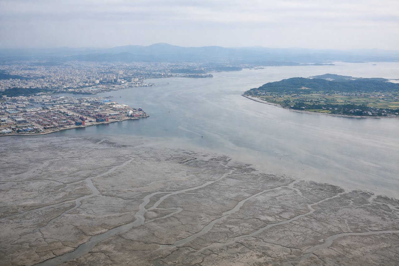
Takeoff from ICN
RIGHTRight-side seats offer views of Seoul's urban sprawl and the Han River as the aircraft climbs. You'll see the city grid and surrounding mountains receding beneath you during the initial climb-out from Incheon.
Landing at JAX
RIGHTRight-side seats provide views of the Atlantic coastline, the St. Johns River estuary, and Jacksonville's downtown as you descend toward JAX. The river's distinctive meanders and the coastal marshlands are particularly visible on approach.
Landmarks on this routeAll landmarks →
Will your flight be in sunlight?
Pick a date and time in the Sun Map to watch the sun move across your whole flight.
About This Route
Which side of the plane should I sit on flying from Incheon International (ICN) to Jacksonville International (JAX)?
Sit on the Right side of the plane for the best views on flights from Seoul to Jacksonville. Right-side seats dominate both departure and arrival phases. You get Seoul's urban landscape and mountains during climb-out, then the Atlantic coastline and St. Johns River estuary during descent into Jacksonville.
What can I see during takeoff from Incheon International in Seoul?
During takeoff from Incheon International (ICN), sit on the Right side for the best views. Right-side seats offer views of Seoul's urban sprawl and the Han River as the aircraft climbs. You'll see the city grid and surrounding mountains receding beneath you during the initial climb-out from Incheon. Notable sights include: Han River (snaking through Seoul), Seoul metropolitan area (dense urban grid), Bukhan Mountains to the north, Yellow Sea coastline to the west.
What can I see when landing at Jacksonville International in Jacksonville?
When landing at Jacksonville International (JAX), sit on the Right side for the best views. Right-side seats provide views of the Atlantic coastline, the St. Johns River estuary, and Jacksonville's downtown as you descend toward JAX. The river's distinctive meanders and the coastal marshlands are particularly visible on approach. Notable sights include: St. Johns River (with characteristic meanders), Atlantic Ocean coastline, Jacksonville downtown skyline, coastal salt marshes and barrier islands.
How long is the flight from Seoul to Jacksonville?
The flight from Incheon International (ICN) to Jacksonville International (JAX) takes about 14 hours. The shortest flight path between them is 7,401 miles (11,911 km); winds and air traffic control usually add a few percent.
What does the Seoul to Jacksonville flight path pass over?
The flight crosses the Pacific Ocean, passing north of Hawaii (typically 200+ miles north, not visible), then crosses North America over the continental United States. Notable geographic features along the route include the Rocky Mountains (visible during daylight hours over Colorado/Wyoming), the Great Plains, and the Mississippi River valley. The flight path generally tracks across the northern tier of the continental US before descending toward Florida's Atlantic coast.